Archaeological and Heritage Services
Specializing in Aboriginal Heritage Assessments, Impact Statements, and GIS Mapping
Development Applications
Heritage and Spatial undertake Aboriginal heritage surveys and prepare cultural heritage reports, cultural heritage management plans, Aboriginal heritage impact statements, and Aboriginal heritage impact permit applications in accordance with the relevant codes of practice within NSW to assist proponents to comply with legislative requirements and local government regulations and DA requirements.
Research
As part of the archaeological investigation process, Heritage and Spatial undertake research into Aboriginal culture and history, and the subject area environment, including landforms, topography, vegetation, soils, geology, and geomorphological processes. This information is used to inform the archaeological predictive models and for planning and targeting investigation activities.
Archaeological Surveys
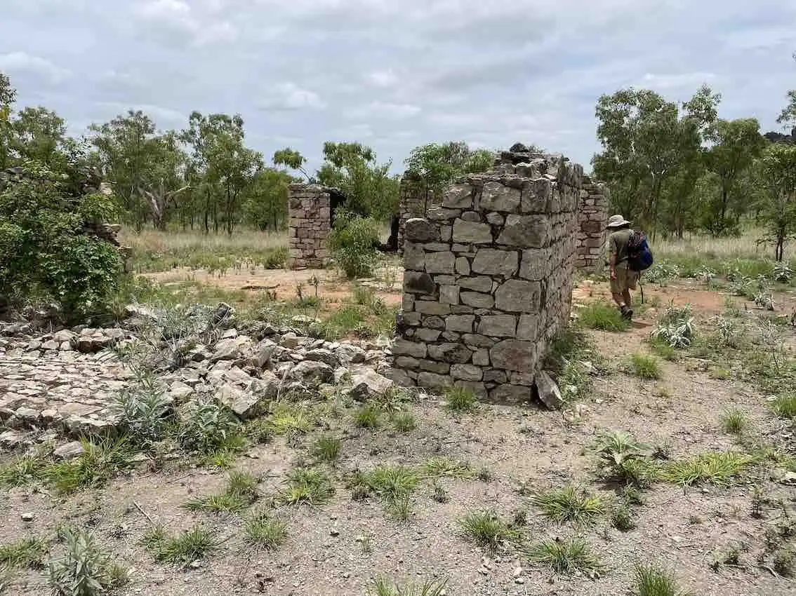
Archaeological surveys are often required as part of the Aboriginal heritage impact assessment process and to demonstrate a proponent has exercised due diligence to prevent impacting heritage items. Our archaeologists are skilled in site inspections and remote area surveys including wilderness and arid environments.
Archaeological Excavation
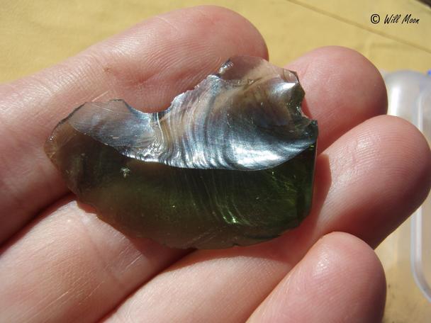
Heritage and Spatial archaeologists are experienced in undertaking archaeological excavation, stratigraphic recording, and lithic analysis. Investigations required as part of cultural heritage reports and assessments may require test and salvage excavation.
Community Consultation
Heritage and Spatial respects that Aboriginal people are the knowledge holders and custodians of their culture. Our archaeologists are experienced in undertaking consultation with traditional owners and knowledge holders, and conducting consultation in accordance with the relevant state and territory codes of practice for Aboriginal consultation.
Geospatial Mapping
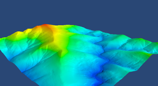
Heritage and Spatial undertakes geospatial mapping and analysis with a range of tools including Postgres/Postgis, Python, QGIS, and R. Common data types used include Shapefiles, LAS, GeoJSON, and GeoTIFF. Geospatial modelling and 3D modelling are undertaken for visualization, understanding trends and predictions, and informing research. We provide GIS services including spatial analysis and the preparation of attractive maps and 3D diagrams for reports and presentations.
Web GIS
Geospatial mapping and modelling capabilities can be built into websites using the Django framework integrated with Postgres, R, Python, Ajax, Javascript, and HTML. Our web maps help avoid the costs associated with subscribed solutions by utilizing open-source solutions. Our solutions include web-based Aboriginal sites recording databases.
Aerial Imagery
Aerial imagery with lightweight drones is used to assess landscapes and heritage sites. Image georeferencing is used to produce accurate site plans of heritage and archaeological sites. Heritage and Spatial undertake drone aerial photography of properties and landscapes within the CASA safety rules and standard operating conditions upon request.